
Geospatial Climate RiskIntelligence Platform
A geospatial climate risk intelligence platform that helps finance, insurance, and property teams assess location-specific climate exposure, visualize risk layers, and generate decision-ready reports.
Climate-Tech & Geospatial Risk Intelligence
IndustryFinancial institutions, insurers, real estate investors, and enterprise risk teams
Target AudienceGenerate hyper-local climate risk reports for asset-level decision-making
Project ObjectiveEmpowering Business with Climate Intelligence
Climes Intelligence is a leading European climate-tech company focused on empowering businesses to thrive amid climate change. Our mission is to help organizations navigate climate impacts, transforming environmental challenges into strategic growth opportunities. We convert complex climate data into actionable, localized insights, enabling rapid, informed decision-making to drive resilience and adaptation across industries.
Financial Institutions
Assess climate exposure across lending, investment, and portfolio decisions.
Insurance Providers
Improve underwriting precision and portfolio resilience with accurate hazard and exposure analytics.
Property Investors
Make data-driven investment decisions with location-specific climate risk intelligence.
The Challenge
Regulatory Pressure: New EU Green Deal, CSRD, and TCFD reporting require forward-looking, scientifically rigorous climate risk disclosures.
Data Fragmentation: Complex climate models, hazard databases, and geospatial data are difficult to integrate into one cohesive decision-making framework.
Risk Complexity: Climate impacts are hyper-localized and require location-specific risk assessment rather than relying on generic models.
Time-Intensive Process: Traditional risk assessments are manual, requiring significant time and effort, which is unsustainable for large portfolios.
Our Solution
ClimesAI GeoRisks offers a cloud-native platform that quickly transforms complex climate data into normalized, regulation-compliant reports in under 60 seconds per asset. It simplifies climate risk assessments, helping businesses make fast, informed decisions while meeting regulatory requirements.
Time Reduction
Report Generation
Risk Categories
Platform Uptime
GeoRisk Physical Risk
Assessment Platform
The GeoRisk Physical Risk Assessment Platform provides businesses with quick and accurate insights into their environmental risks. It enables companies to make strategic, data-driven decisions about their assets' exposure to hazards like floods, wildfires, and earthquakes. By leveraging hyper-local data, forward-looking projections, and AI-driven insights, the platform empowers organizations to prepare for and adapt to climate change efficiently.









Hyper-Local
Accuracy
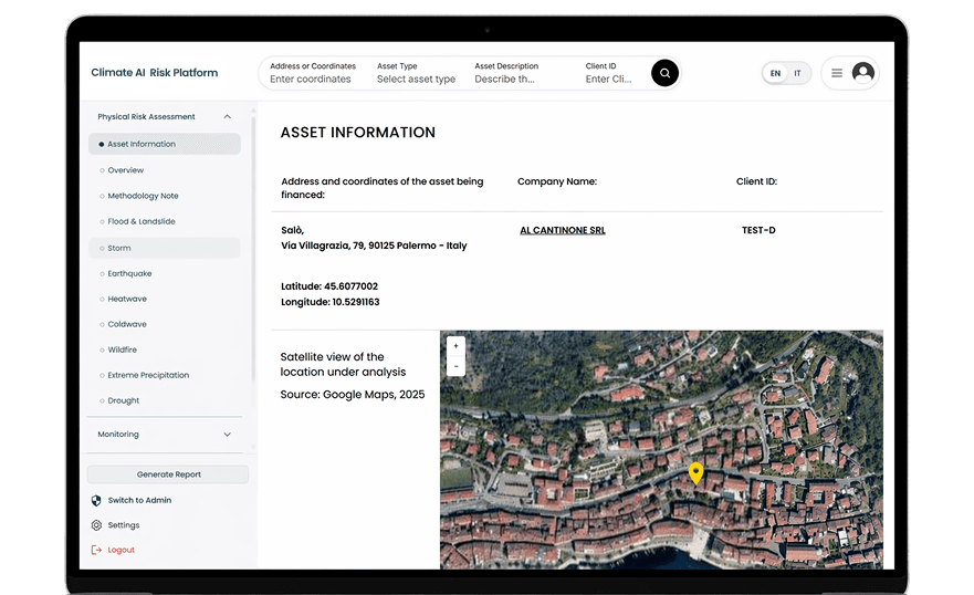
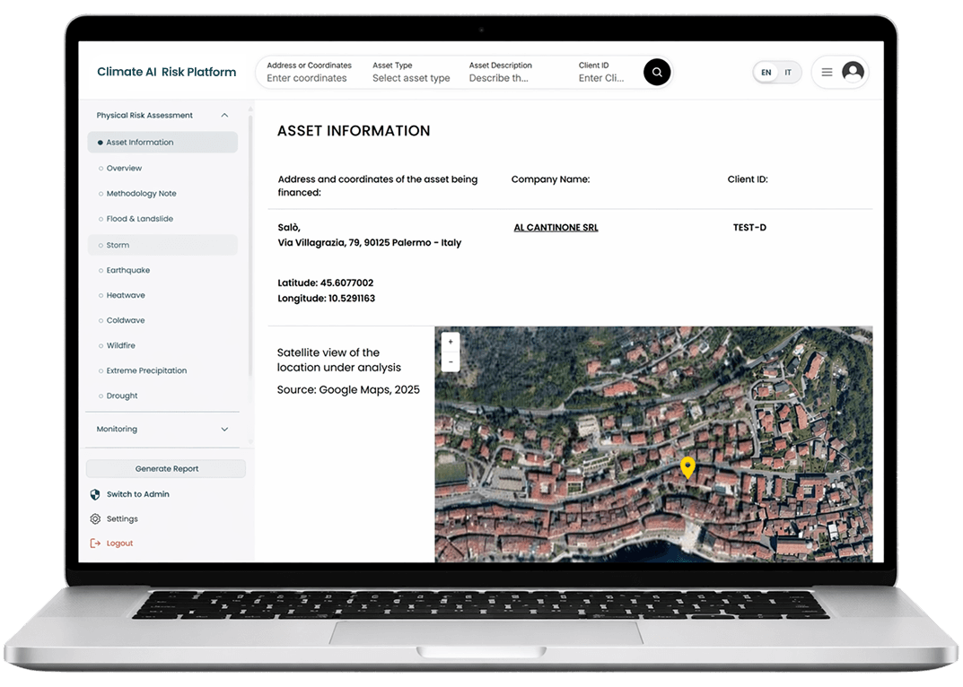
Offers precise, coordinate-based risk assessments using interactive satellite maps.
Core Platform Features

Location-Specific Assessment
Precise coordinate-based analysis enables hyper-local risk evaluation for individual assets with high spatial accuracy.
- Satellite map visualization
- Risk overlays and spatial context
- Export-ready geospatial outputs
Comprehensive Risk Modeling
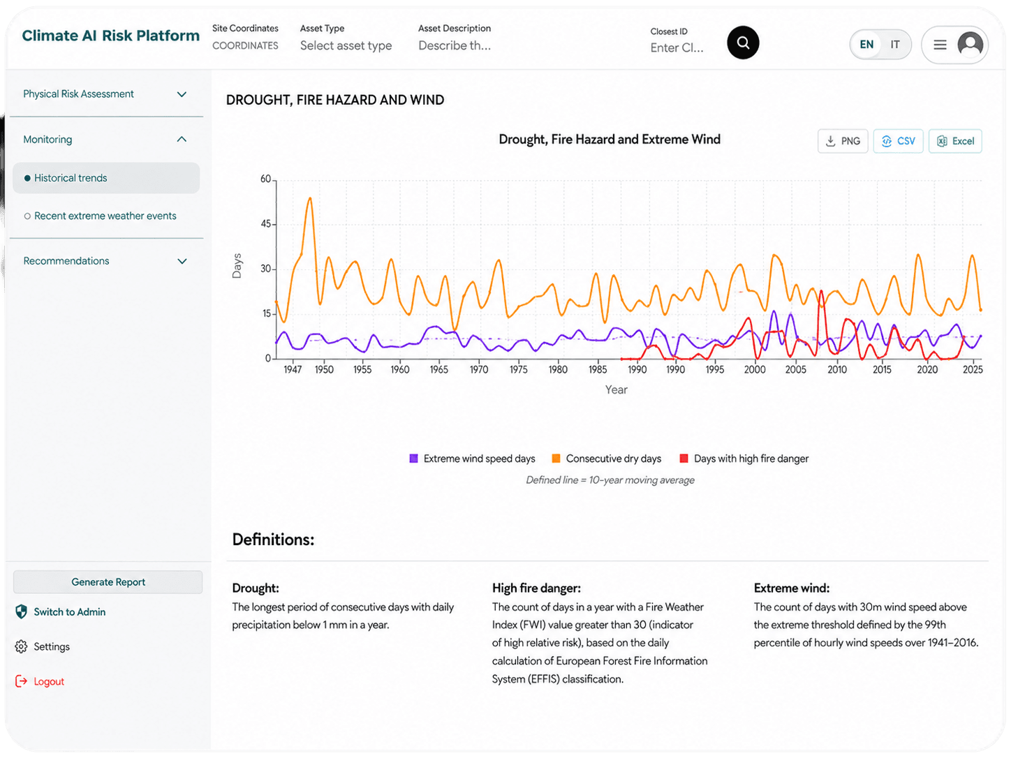
Enterprise-grade risk modeling that fuses ISPRA and ESWD datasets with historical and projected hazard trends for robust exposure analysis.
- ISPRA and ESWD datasets
- Historical and projected risk trends
- Multi-hazard exposure modeling

AI-Enhanced Intelligence
AI models transform complex hazard data into clear, decision-ready narratives and risk interpretations at scale.
- LLM-powered narrative generation
- AI-driven risk interpretation
- Automated data normalization & validation

Multilingual Interface
Enterprise-ready experience with seamless language switching across platform, reports, and insights.
- English and Italian support
- Localized report generation
- Consistent UI across regions
Instant Report Generation
Automated generation of professional, decision-ready reports in seconds.
- < 60s report delivery
- Structured multi-page PDFs
- Compliance-ready formatting

Forward-Looking Projections
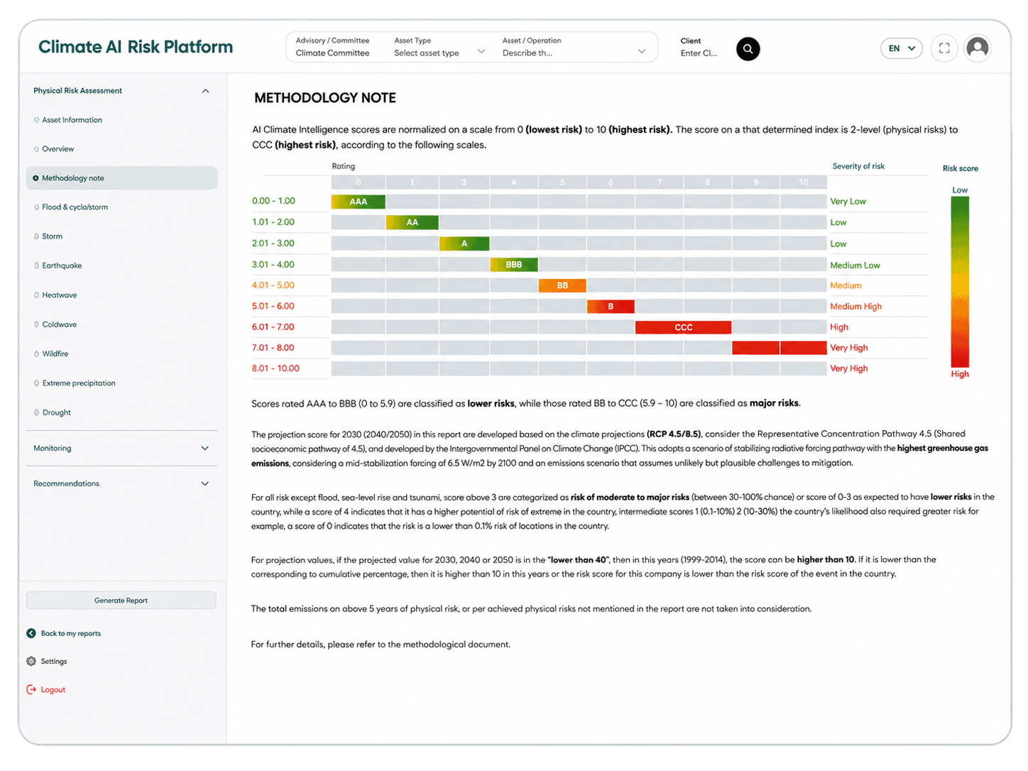
Future risk scenarios modeled across key time horizons to support long-term strategic planning.
- 2030, 2040, 2050 projections
- RCP 4.5 / 8.5 scenarios
- Time-based risk comparisons
Platform in Action
Hazard Analytics & Exposure Mapping
The Climate AI GeoRisk Platform demonstrates our expertise in delivering data-intensive, AI-enhanced solutions for climate-risk intelligence in regulated industries — transforming complex scientific data into actionable business insights.
Build on a Modern Scalable Stack
Enterprise-grade architecture designed for performance, scalability, and regulatory compliance across data, AI, and cloud infrastructure.

Geospatial Data Layer
Hazard, climate, asset, and location data connected into one risk model.

Risk Modeling Layer
Location-specific exposure assessment across climate and physical risk categories.

Dashboard & Review Layer
Interactive views for asset review, report access, and risk comparison.

Security & Operations Layer
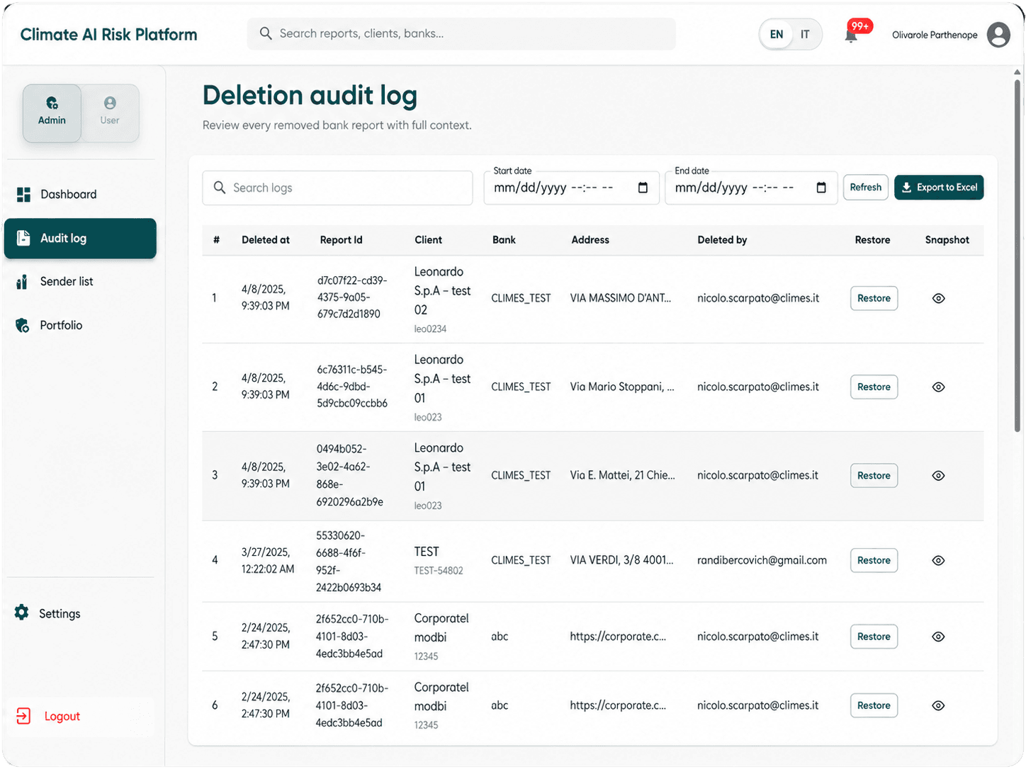
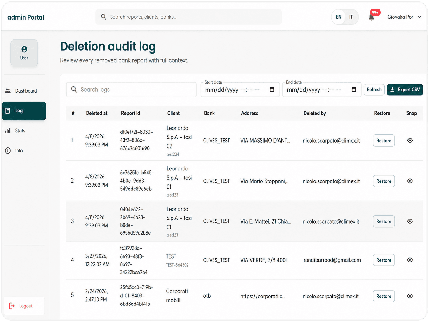
Role-based access, controlled data handling, monitoring, and production operations.

AI Report Generation Layer
Structured summaries, maps, narratives, and review-ready risk reports.
Target Markets & Use Cases
Financial Institutions
Banks and lenders requiring TCFD/CSRD-aligned climate risk disclosures for loan portfolios and asset financing decisions
Insurance Providers
Underwriters and risk managers assessing physical risk exposure for property, casualty, and commercial insurance products
Property Investors
Asset managers and REITs evaluating climate risk for property acquisitions and portfolio resilience planning
Real Estate & Infrastructure Teams
Assess site-level exposure and support long-term resilience planning.
From Brief to Production in 20 Weeks
A structured, milestone-driven process with regular client check-ins ensured the platform launched on time, on budget, and with full feature coverage.
Data Foundation & Backend
Structured climate, location, and asset-related data for platform use.
AI Intelligence Layer
Built AI-assisted workflows for risk interpretation and report generation.
Platform Experience
Designed dashboard, map, report, and user workflows for business-facing climate analysis.
Production Handover
Prepared the platform for testing, documentation, operational use, and handover.
Explore Other Case Studies

Book a Consultation
Schedule a 30-minute call to discuss your project scope and technical requirements.